



R.E.News future Technology-GNSS Research Identifies Factors Behind Centimetre-Level Positioning Accuracy
 30/10/26-FR-English-NL-footer
GNSS : l’intelligence artificielle au service du positionnement au centimètre près
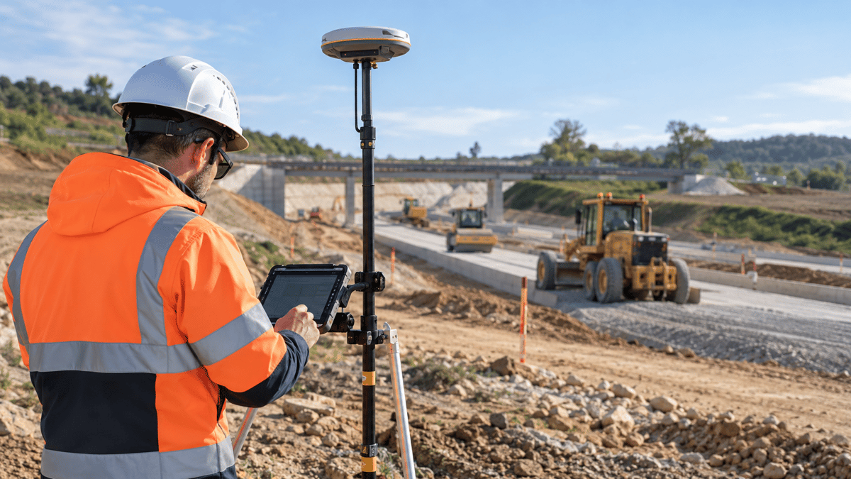 Image-creation R.E.News© via IA chat GPT
Quelques millimètres peuvent faire la différence sur un chantier de haute précision. Des chercheurs de York University et de Sun Yat-sen University ont analysé 440 stations GNSS internationales afin de comprendre pourquoi certains systèmes de correction satellite offrent une précision supérieure à d’autres.
Publiée dans la revue scientifique Satellite Navigation, leur étude compare des solutions de positionnement PPP-AR combinant GPS, Galileo et BeiDou-3. Résultat : avec les produits de correction testés de l’université de Wuhan, 98 % des solutions atteignent le seuil de 2,5 cm de précision horizontale dès la première époque de traitement, contre 90 % avec les produits CNES/GBM.
Après convergence, l’erreur horizontale moyenne atteint seulement 0,8 cm avec les corrections WUM, contre 1,2 cm avec GBM. La différence s’explique notamment par la disponibilité des corrections nécessaires à l’exploitation des différents signaux satellites.
L’intelligence artificielle décrypte les signaux
Grâce aux algorithmes Random Forest et XGBoost, les chercheurs ont identifié plusieurs facteurs associés à la précision : répartition des satellites dans le ciel, qualité des signaux, altitude des satellites et géométrie de réception. La distribution des satellites influence particulièrement la précision horizontale, tandis que leur géométrie joue un rôle important dans les mesures verticales.
Un enjeu majeur pour les chantiers routiers
Ces résultats intéressent directement le secteur des travaux publics. Le guidage GNSS des niveleuses, des finisseurs et des excavatrices dépend de données fiables pour respecter les profils et les niveaux de terrassement. Les mêmes technologies peuvent contribuer aux relevés topographiques et au suivi des infrastructures.
L’étude a toutefois été réalisée sur des stations fixes : des essais supplémentaires seront nécessaires pour confirmer ces performances sur des machines en mouvement, dans des environnements encombrés ou soumis aux réflexions des signaux.
La précision du chantier de demain ne dépendra donc pas uniquement du récepteur satellite, mais aussi de la qualité des corrections, de la géométrie des signaux et de la capacité à détecter les conditions qui dégradent les mesures.
NJC.© Info Satellite Navigation https://link.springer.com/article/10.1186/s43020-026-00223-x
------------------------------------------------------------------------------------------------------------------------
30/10/26-English
GNSS: Artificial Intelligence for Centimeter-Precise Positioning
Image-creation R.E.News© via IA chat GPT
A few millimeters can make all the difference on a high-precision construction site. Researchers from York University and Sun Yat-sen University analyzed 440 international GNSS stations to understand why some satellite correction systems offer superior accuracy compared to others.
Published in the scientific journal Satellite Navigation, their study compares PPP-AR positioning solutions combining GPS, Galileo, and BeiDou-3. The result: with the correction products tested from Wuhan University, 98% of the solutions reached the 2.5 cm horizontal accuracy threshold in the first processing epoch, compared to 90% with the CNES/GBM products.
After convergence, the average horizontal error reached only 0.8 cm with the WUM corrections, compared to 1.2 cm with GBM. This difference is explained in particular by the availability of the corrections necessary for processing the various satellite signals.
Artificial intelligence deciphers signals
Thanks to the Random Forest and XGBoost algorithms, researchers have identified several factors associated with accuracy: satellite distribution in the sky, signal quality, satellite altitude, and reception geometry. Satellite distribution particularly influences horizontal accuracy, while their geometry plays a significant role in vertical measurements.
A major challenge for road construction sites
These results are of direct interest to the public works sector. GNSS guidance for graders, pavers, and excavators depends on reliable data to ensure accurate profiles and earthwork levels. The same technologies can contribute to topographic surveys and infrastructure monitoring.
However, the study was conducted on fixed stations: further testing will be necessary to confirm these results on moving machines, in cluttered environments, or in areas subject to signal reflections.
The accuracy of tomorrow's construction site will therefore depend not only on the satellite receiver, but also on the quality of the corrections, the geometry of the signals, and the ability to detect conditions that degrade measurements.
NJC.© Info Satellite Navigation https://link.springer.com/article/10.1186/s43020-026-00223-x
------------------------------------------------------------------------------------------------------------------------
30/10/26-NL
GNSS: Kunstmatige intelligentie voor positionering met centimeterprecisie
Image-creation R.E.News© via IA chat GPT
Een paar millimeter kan het verschil maken op een bouwplaats waar precisie vereist is. Onderzoekers van York University en Sun Yat-sen University analyseerden 440 internationale GNSS-stations om te begrijpen waarom sommige satellietcorrectiesystemen een superieure nauwkeurigheid bieden in vergelijking met andere.
Hun onderzoek, gepubliceerd in het wetenschappelijke tijdschrift Satellite Navigation, vergelijkt PPP-AR-positioneringsoplossingen die GPS, Galileo en BeiDou-3 combineren. Het resultaat: met de correctieproducten van Wuhan University bereikte 98% van de oplossingen de drempel van 2,5 cm horizontale nauwkeurigheid in de eerste verwerkingsronde, vergeleken met 90% met de CNES/GBM-producten.
Na convergentie bedroeg de gemiddelde horizontale fout slechts 0,8 cm met de WUM-correcties, vergeleken met 1,2 cm met GBM. Dit verschil wordt met name verklaard door de beschikbaarheid van de correcties die nodig zijn voor de verwerking van de verschillende satellietsignalen.
Kunstmatige intelligentie ontcijfert signalen
Dankzij de Random Forest- en XGBoost-algoritmen hebben onderzoekers verschillende factoren geïdentificeerd die verband houden met nauwkeurigheid: de verdeling van satellieten in de lucht, de signaalkwaliteit, de hoogte van de satelliet en de ontvangstgeometrie. De verdeling van satellieten heeft met name invloed op de horizontale nauwkeurigheid, terwijl hun geometrie een belangrijke rol speelt bij verticale metingen.
Een grote uitdaging voor wegenbouwprojecten
Deze resultaten zijn direct relevant voor de openbare werkensector. GNSS-geleiding voor graders, asfalteermachines en graafmachines is afhankelijk van betrouwbare gegevens om nauwkeurige profielen en grondwerkhoogtes te garanderen. Dezelfde technologieën kunnen bijdragen aan topografische metingen en infrastructuurmonitoring.
Het onderzoek werd echter uitgevoerd op vaste stations: verder onderzoek is nodig om deze resultaten te bevestigen op bewegende machines, in omgevingen met veel obstakels of in gebieden met signaalreflecties.
De nauwkeurigheid van de bouwplaats van morgen zal daarom niet alleen afhangen van de satellietontvanger, maar ook van de kwaliteit van de correcties, de geometrie van de signalen en het vermogen om omstandigheden te detecteren die metingen beïnvloeden.
NJC.© Satellite Navigation Info https://link.springer.com/article/10.1186/s43020-026-00223-x
---------------------------------------------------------------------------------------------------------------------
Date de dernière mise à jour : 29/10/2026